Published on Tuesday, 16 September 2025 at 8:00:00 AM
Welcome to #TimeWarpTuesday. Did you know that our very own Victoria Park has a connection to the famed 10th Light Horse Regiment?
Recent conversations and research with Richard Jones who was in the Citizens Military Force (CMF), have uncovered a piece of history lost to housing development and urban sprawl….some may remember Holdfast Barracks on the Canning Highway down near the Swan? But did you know that from 1914 to sometime in the latter half of the 1980s, we had our very own Drill Hall located at 32 State Street, Victoria Park.
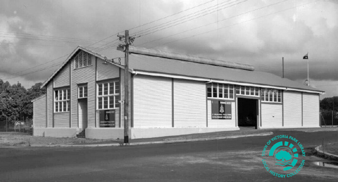
PH00466-01 - 3 Composite Ordinance Depot, at the Victoria Park Drill Hall, 32 State Street, Victoria Park, c.1961
Courtesy of Richard Jones
The Victoria Park Drill Hall was situated on land the size of six house blocks (of the old-fashioned larger style) and was bordered by three streets – State, Washington and Tuam Streets.
A Facebook contact of Richard’s shared the photo of the Drill Hall in this post. The photo dates to circa 1961 when it was home to the Australian Army’s 3 Composite Ordinance Unit, and it is their colour patch and signage that can be seen on the Drill Hall. The photographer has captured the image from the corner of State and Washington Streets. The larger double doors to the right of the image faced State Street and at the left of the photo, the smaller front door of the hall is facing Washington Street. The parade ground or drill area was located immediately to the right of the Drill Hall (and right of photo behind bushes) and also ran along State Street. The Victoria Park Drill Hall at the time of the photograph was believed to mainly house clerical and records personnel more than ordinance itself, with the main ordinance depot being based out in Bushmead, near Midland.
We know that the 10th Light Horse Regiment was located at the Victoria Park Drill Hall prior to its relocation to Karrakatta in 1960, but we don’t know much more than that. Can you help shed any light on this part of our history? Do you have photographs, memorabilia, ephemera or stories to share? Perhaps you were stationed at or trained at the Victoria Park Drill Hall? If you can help, please don’t hesitate to get in touch with the Local History Coordinator, by phone (08) 9373 5500, by email: vicparklibrary@vicpark.wa.gov.au, by post: PO Box 1109 East Victoria Park WA 6981 or in person: 27 Sussex Street, East Victoria Park WA 6101.
We’ll keep you posted on developments, but until next time don’t forget to honour the past and protect the future by telling the and sharing the stories today. Happy #TimeWarpTuesday folks!
#LoveVicPark
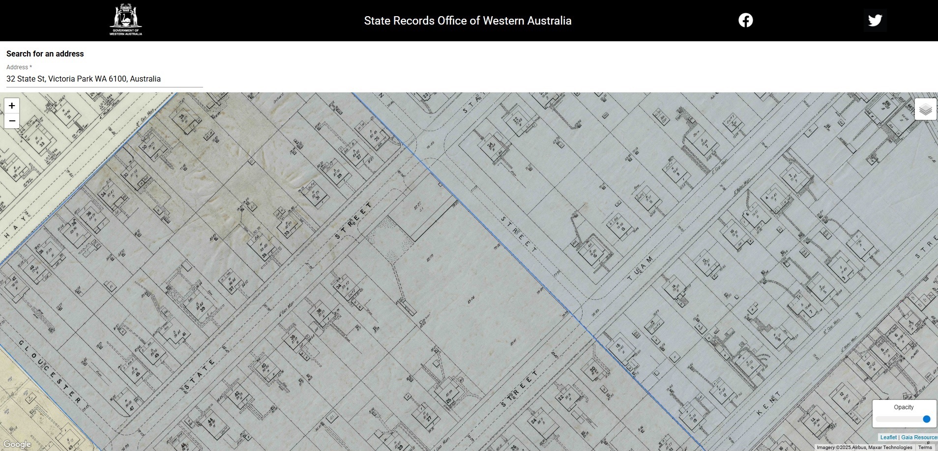
Screenshot of the 1936 sewerage map showing the Victoria Park Drill Hall ‘footprint’ at 32 State Street, Victoria Park.
Courtesy Retromaps, an initiative of the State Records Office of Western Australia (https://mapping.sro.wa.gov.au/#/)
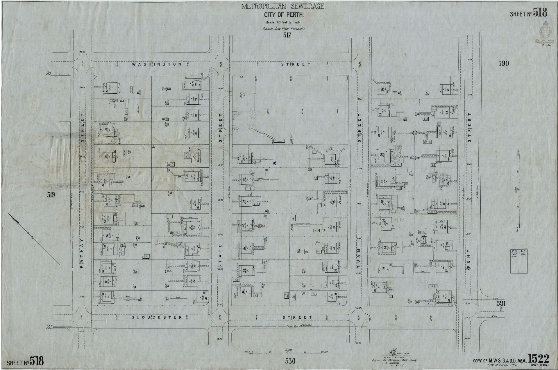
Victoria Park Drill Hall as seen on the Metropolitan Sewerage [Map], Sheet No. 518, City of Perth, drawn 11.9.1936.
Scale : 40 Feet to 1 inch.
Courtesy of RetroMaps, an Initiative of the State Records Office of Western Australia (https://mapping.sro.wa.gov.au/maps/SROWA_series634_cons4156_item0518.jpg)
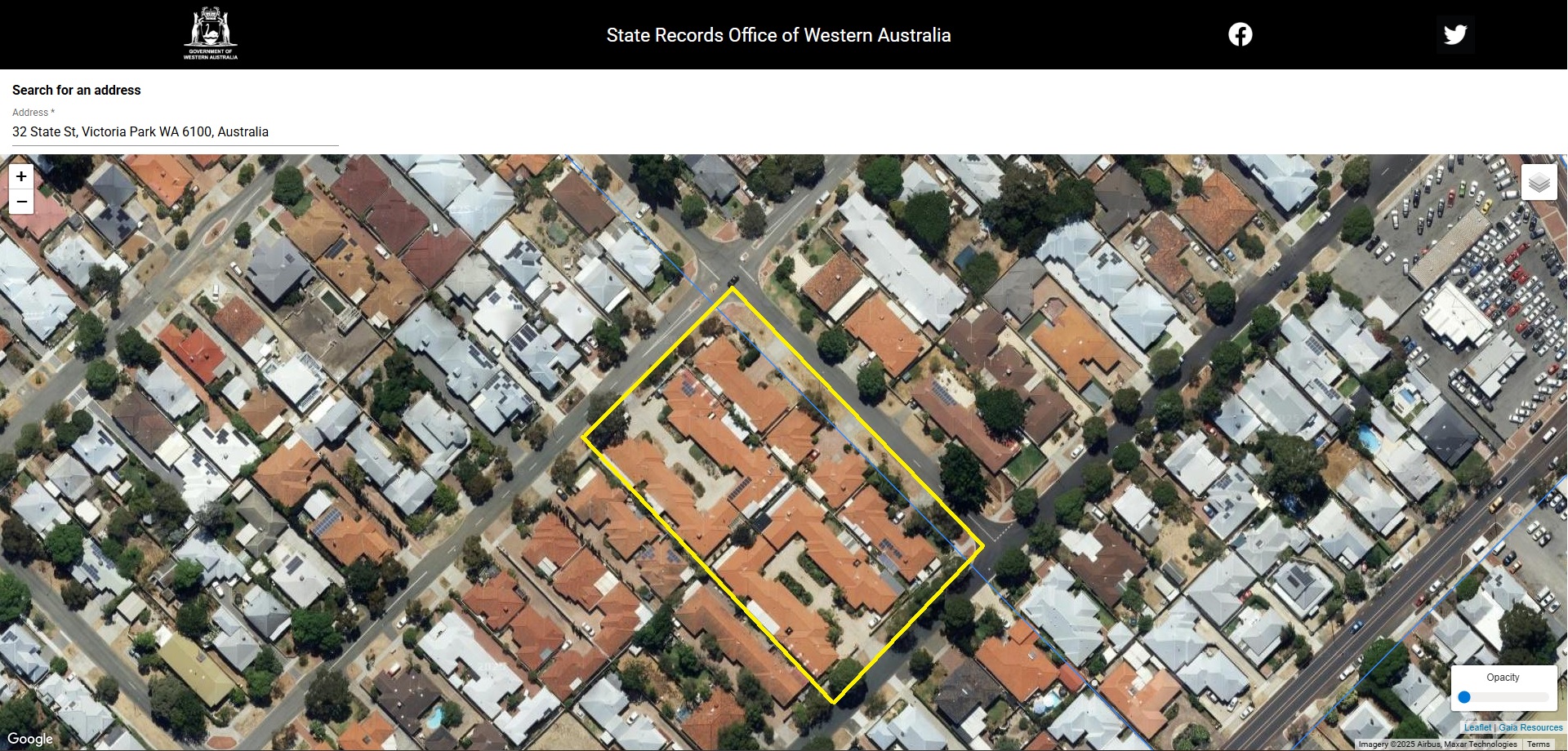
32 State Street, the site of the old Victoria Park Drill Hall, as it is today.
The yellow line has been added by the Local History Coordinator to highlight the size of the original site.
Courtesy Retromaps, an initiative of the State Records Office of Western Australia (https://mapping.sro.wa.gov.au/#/)
Back to All News